ACRES ENTERPRISE
See How Land Teams Are Using AI to Win Deals

Book a Demo
Trusted by Acquisition, Development, and Investment Teams Nationwide
Parcel Intel
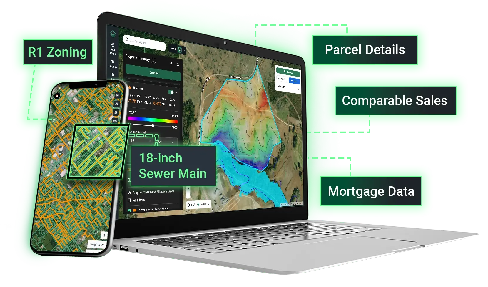
Get the Complete Picture Behind Any Parcel
- Instantly connect properties, ownership, debt, and purchases associated with an owner name or address.
- Centralize every layer of due diligence — from zoning and risk to ownership verification — in one AI-powered panel.
Instant Reports
Create Instant Valuation and Property Reports
- Go from research to shareable reports in minutes with PDF or Excel exports.
- Add your branding and select what data you want to include for easy customization.
Targeted Lists
Build Targeted Lead Lists in Minutes
- Search by owner name, mailing address, or within defined boundaries, like zoning or zip codes.
- Generate lead lists based on parcel or transaction data. 10,000 leads included for new accounts.
- Map loan portfolios with a national mortgage database, and find maturing loans in your market.
Team Alignment
Keep Your Team Aligned with a Shared Portfolio
- Organize your team's portfolio to match your workflow with custom columns and tags.
- Save and view property information from a secure, centralized dashboard.
- Collaborate across teams and divisions with a shared view that gives you ultimate visibility.
“We are always looking for ways to strengthen our land acquisition strategy and empower our teams with tools that improve decision-making. Acres helps us streamline workflows and ensure data consistency across divisions, allowing us to better serve our homebuyers and communities.”
Scott Hair, Regional Corporate Director of LandCentury Communities
“We have been using Acres in our appraisal department for the past two years, and it has become one of our primary tools for agricultural sales and property research. The staff at Acres has been very proactive about adding features to the platform based upon user feedback, which has been extremely helpful.”
Greg Peters, VP and Director of Appraisal OperationsGolden State Farm Credit
National Coverage. Always Up-to-Date.
1000 +
Data Sources
150 M+
Parcel Records
45 M+
Land Transactions
12000
Map Layers
Precision Lead Lists
Build targeted lead lists based on your specific criteria.

Parcel Summary
See every data point for a parcel in a single panel. Analyze risk and opportunity at a glance.

Sales Data
Find relevant comparable sales using nationwide data.

Custom Maps
Draw boundaries, attach photos, and add geotags to showcase properites.

Skip Tracing
Access current phone numbers and email addresses for landowners nationwide.

Asset Intelligence
Connect parcels, purchases, and mortgages to their true owners in one interactive view.

Site Planner
Build custom site plans and get instant calculations on lot yield, buildable acres, and road length.

Image Overlay
Upload your own imagery to the map to see how your plans align with the surrounding area.

Acres Enterprise
%20White.png?width=822&height=672&name=Acres(r)%20White.png)
%20Light.png?width=820&height=672&name=Acres(r)%20Light.png)