


Complete AI Land Intelligence
Acres Intelligence gives land teams a single system for sourcing, diligence, and strategy. Evaluate opportunities faster with access to the most extensive land database available.

45m+ Land Transactions
Find the Latest Land Sales Data, Nationwide
- Access coverage nationwide, even in non-disclosure states.
- Get contextual details with every sale.
- Quick search filters, including acreage, sale date, zoning, buyer, seller, and more.
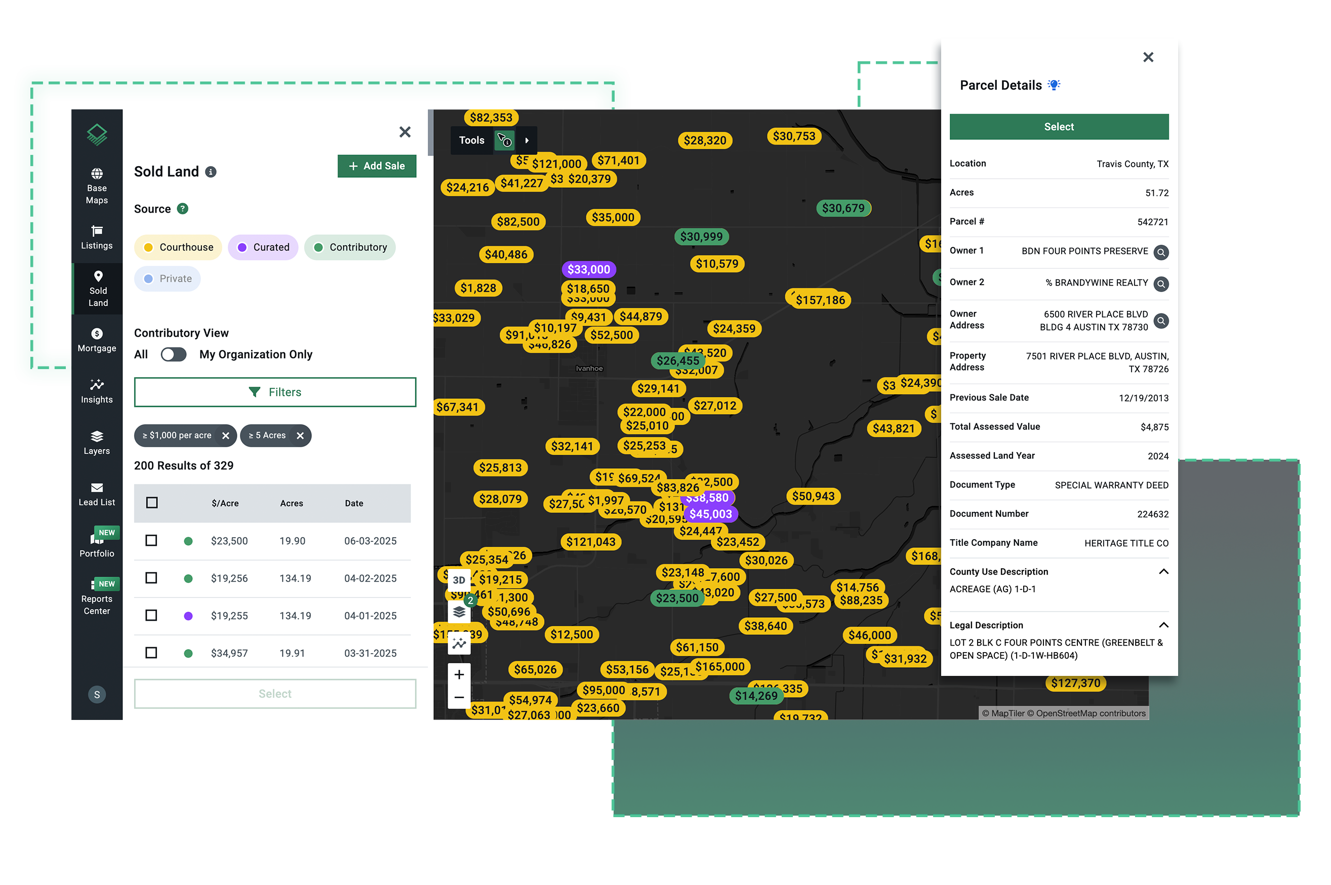
150m+ Parcel Records

Search Up-to-Date Parcel Records
- Connect parcels, purchases, and mortgages to their true owners.
- Instantly see all associated map layers and assets with AI insights.
- Understand portfolio size and patterns of landowners nationwide.
25m+ Mortgages
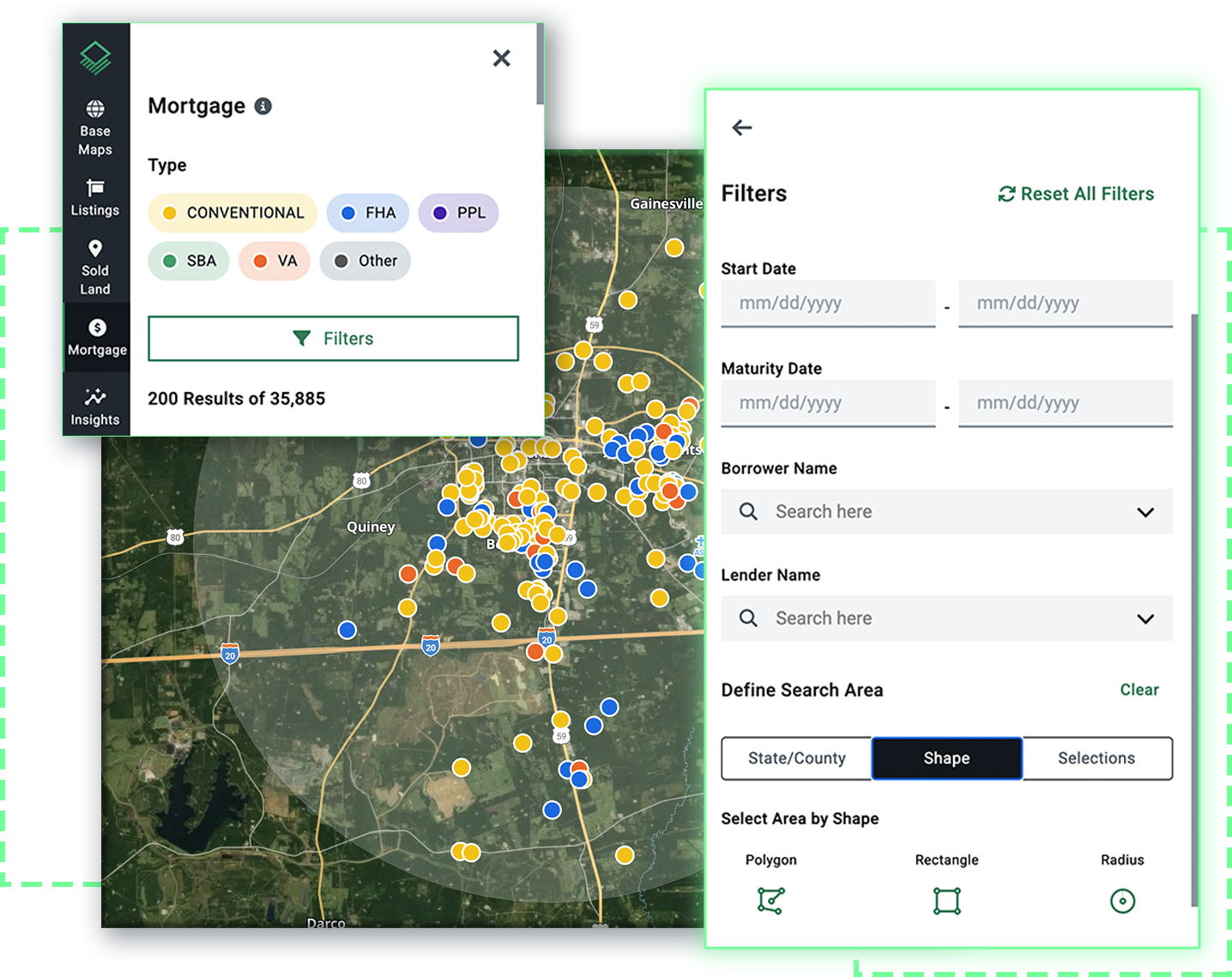
Find Leads and Research the Competition
- Search by borrower name or lender name.
- Filter by maturity date, start date, mortgage amount, and more.
- Find mortgages within a defined area, like specific zoning codes or school districts.
10,000+ Layers
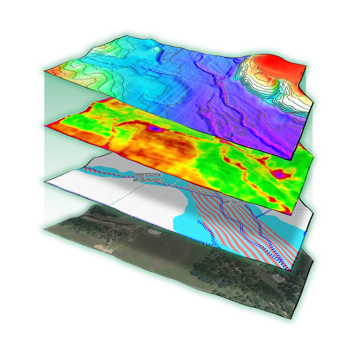
Instantly Visualize the Data You Need
- Access the most recent, extensive land data available.
- Search thousands of datasets, including zoning, infrastructure, demographics, and more.
- View parcel-level insights, including nationwide lidar topography maps, FEMA flood risk, and historic satellite imagery.
Find the Latest Land Sales Data, Nationwide
- Access coverage nationwide, even in non-disclosure states.
- Get contextual details with every sale.
- Quick search filters, including acreage, sale date, zoning, buyer, seller, and more.
Search Up-to-Date Parcel Records
- Connect parcels, purchases, and mortgages to their true owners.
- Instantly see all associated map layers and assets with AI insights.
- Understand portfolio size and patterns of landowners nationwide.
Find Leads and Research the Competition
- Search by borrower name or lender name.
- Filter by maturity date, start date, mortgage amount, and more.
- Find mortgages within a defined area, like specific zoning codes or school districts.
Instantly Visualize the Data You Need
- Access the most recent, extensive land data available.
- Search thousands of datasets, including zoning, infrastructure, demographics, and more.
- View parcel-level insights, including nationwide lidar topography maps, FEMA flood risk, and historic satellite imagery.


