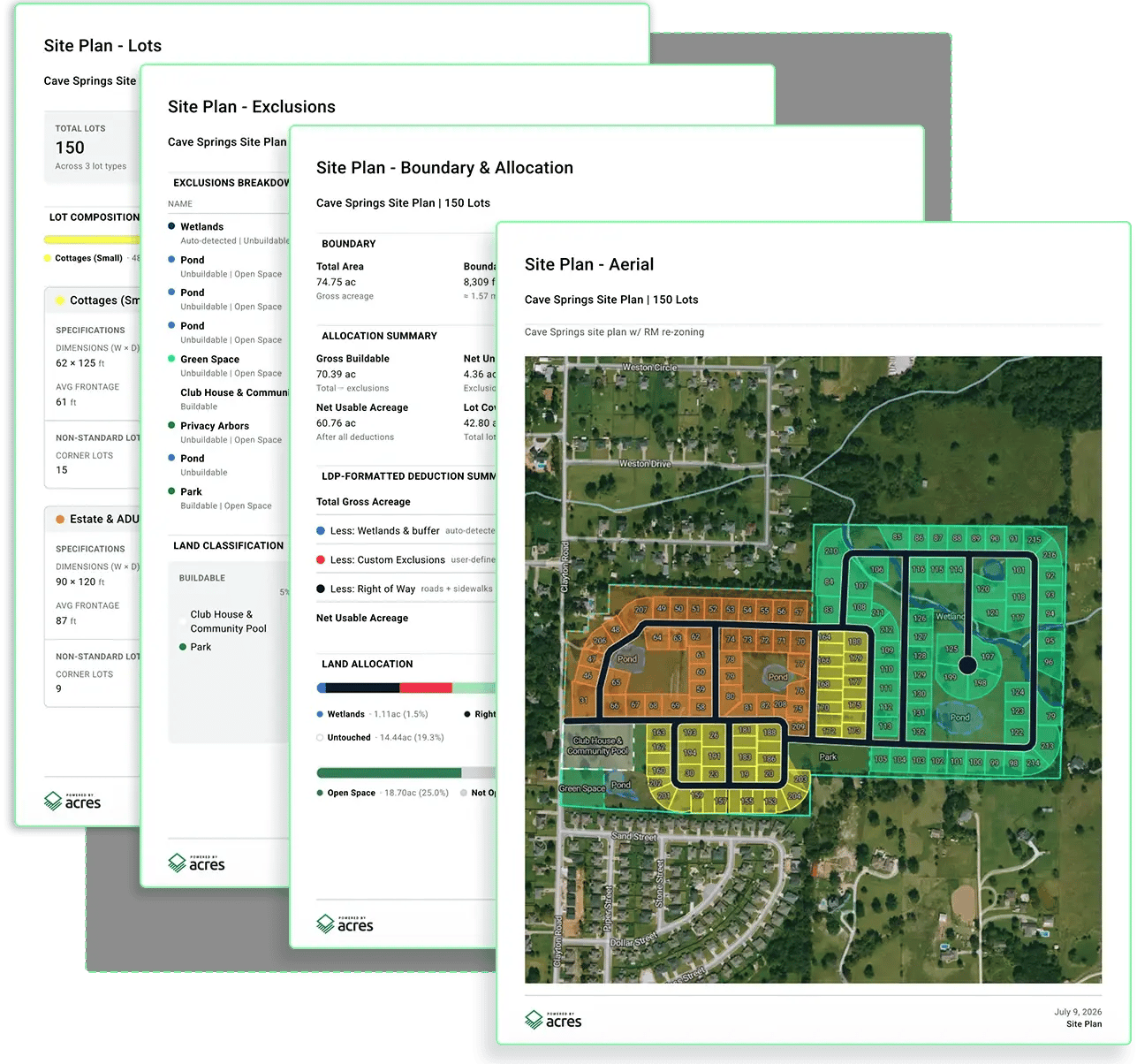
Turn any parcel into a credible site plan within minutes of hitting your desk. Run lot yield and feasibility analysis, plan around constraints, and give your team clear direction before committing engineering time and spend.
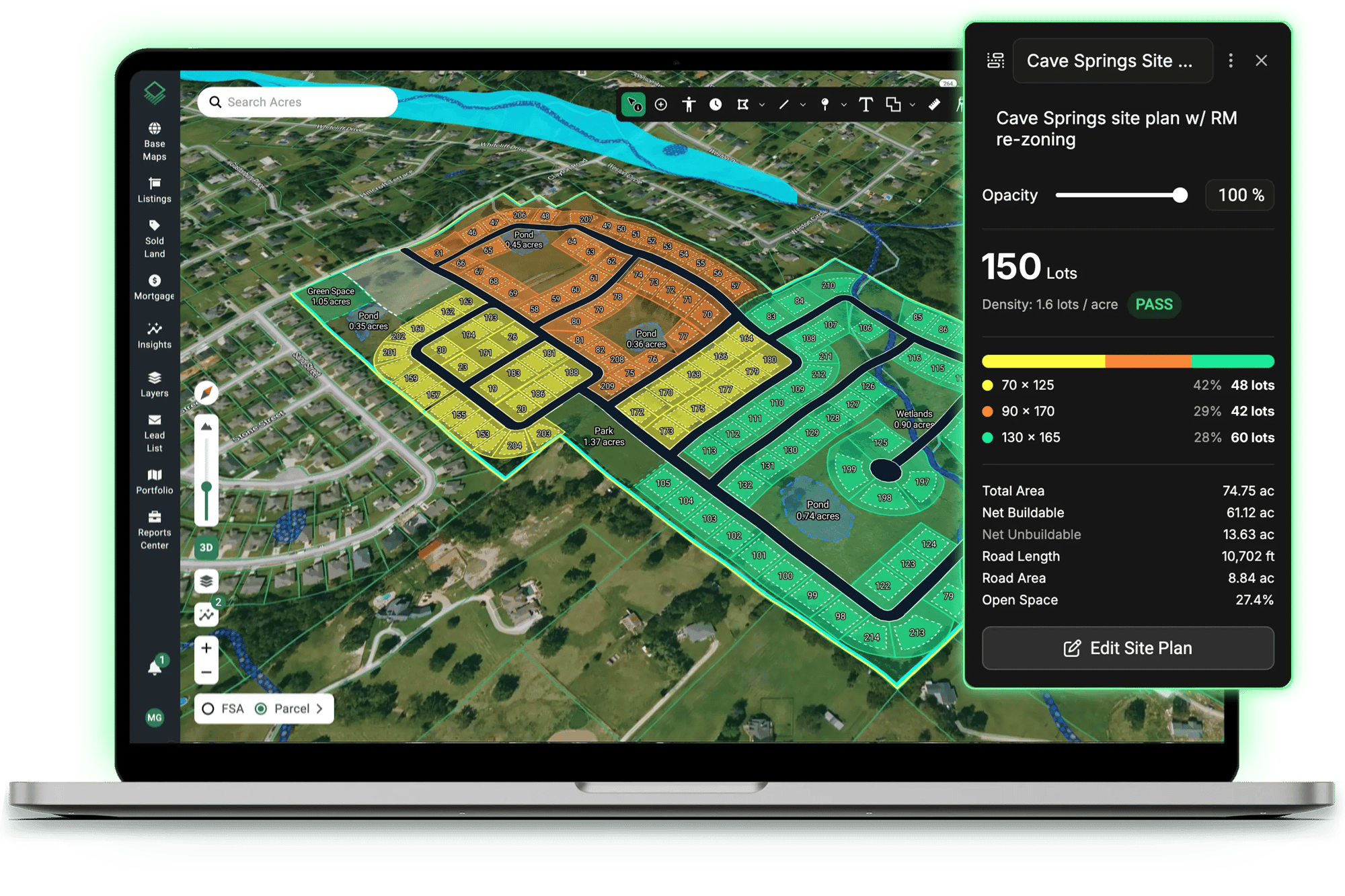
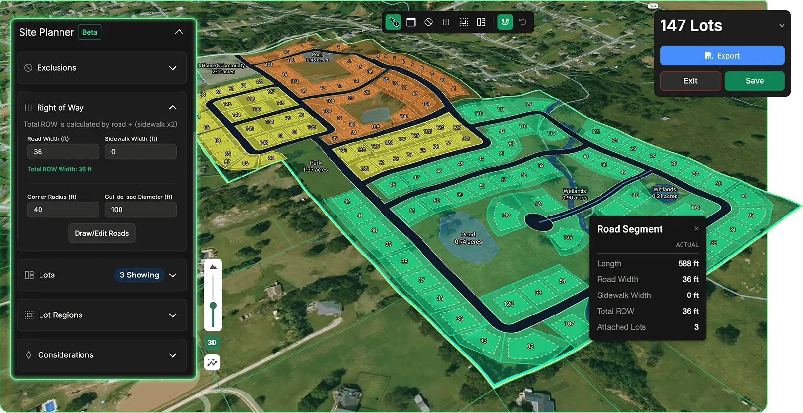
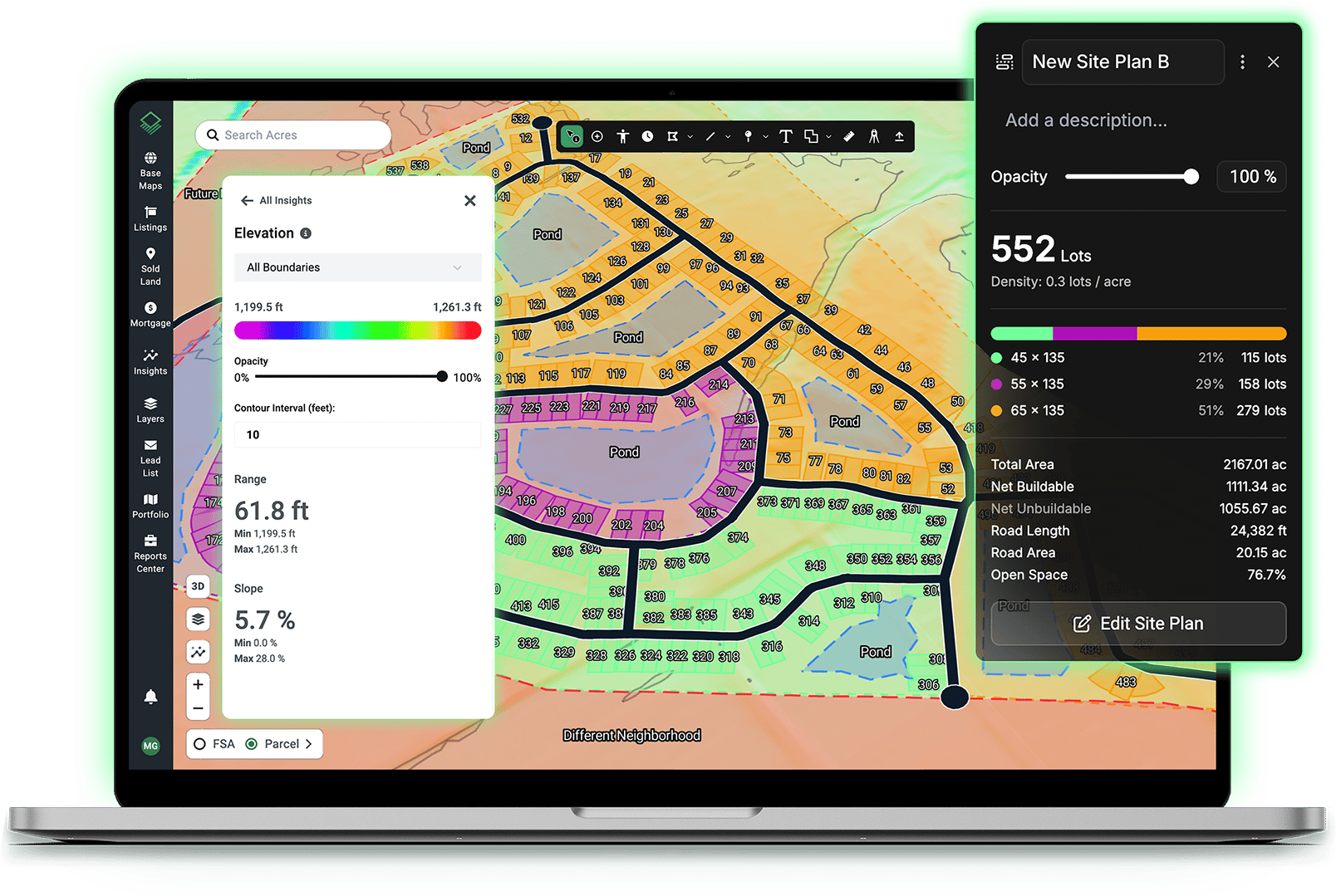
Generate realistic lot yields that reflect how your team actually builds. Test a different road pattern, resize a lot type, or add a restriction and watch the yield recalculate instantly.
Plan Around Site Constraints From the Start
Wetlands and flood zones are automatically detected and excluded from your layout, and a live density check shows whether your plan passes or fails. Focus your team's time on parcels with a viable path forward.
Know Exactly How Your Plans Line Up
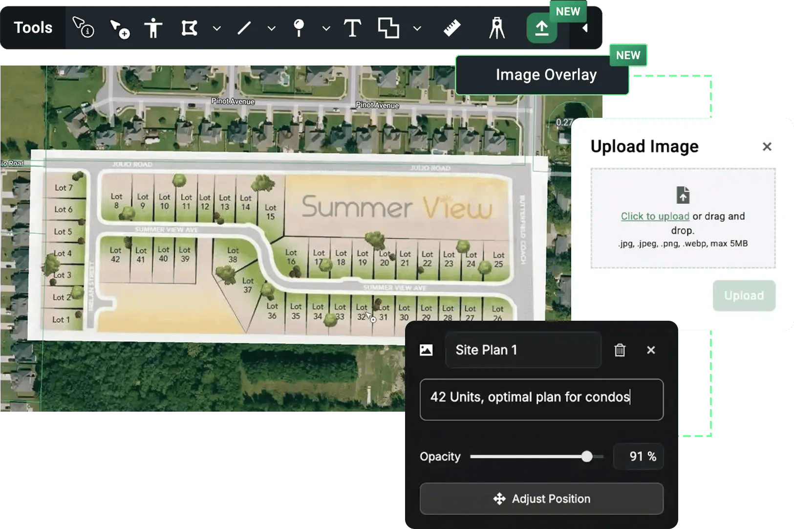
Overlay your own imagery on the map to see how your plans align with parcels, roads, and the surrounding area.
Export a Report Your Engineer Can Build On
Generate actionable, branded PDFs with site maps, exclusions, and full statistical breakdowns to give your engineer the complete picture from the start.
TRADITIONAL METHODS
Timeline
Takes 1–2 weeks waiting on an engineer for a preliminary layout before you know the lot count.
Process
Manually pull zoning codes, flood data, and density limits together by hand, county by county.
Budget
Spend engineering fees on sites that turn out to be unbuildable.
Risk
Move on instinct, or lose the deal while the analysis catches up.
WITH ACRES' SITE PLANNER
Timeline
Generate a realistic lot yield in minutes - the same day the parcel hits your desk.
Process
Automated checks - wetlands and flood zones are detected and excluded from the start.
Budget
Reserve engineering spend for parcels that already show viable yield.
Risk
Pass on bad fits instantly, and move fast on the ones worth pursuing.
Start creating site plans that reflect how your team actually builds.