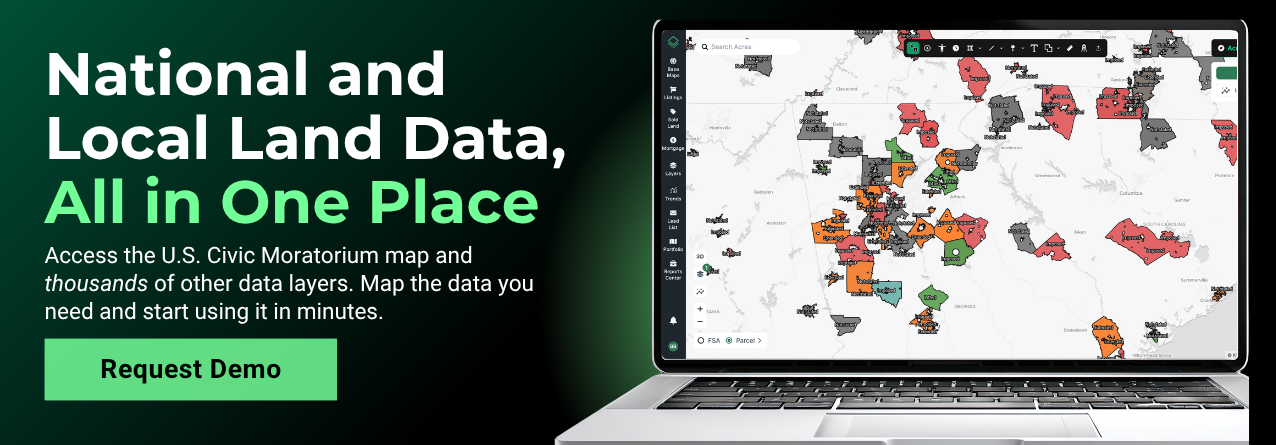


A single vote at a city council meeting can freeze an entire category of development overnight. For data centers, battery storage, solar farms, or multifamily housing development across the country, local governments are pressing pause while they reconsider rules. If you're selecting sites, buying land, or advising clients, knowing where those pauses are in effect is crucial.
With Acres.com, you can use the Civic Moratorium map layer to see which jurisdictions have imposed moratoriums nationwide, and click straight through to the meeting minutes where each one was recorded.
What is a Civic Moratorium?
A civic moratorium is a temporary pause that a city, county, or township places on a specific type of development or permit. While it's in effect, the local government typically won't accept, process, or approve applications for that use.
A board may want to study infrastructure capacity, draft new zoning and land use rules, or gather public input before a new type of project arrives in force. Most carry an expiration date, but many are extended once or more before they're lifted or replaced by permanent ordinances.
Recently, moratoriums have clustered around fast-growing land uses like hyperscale data centers, battery energy storage systems (BESS), solar, and large residential subdivisions.
Map of U.S. Civic Moratoriums: How to Track Active Zoning and Building Moratoriums Nationwide
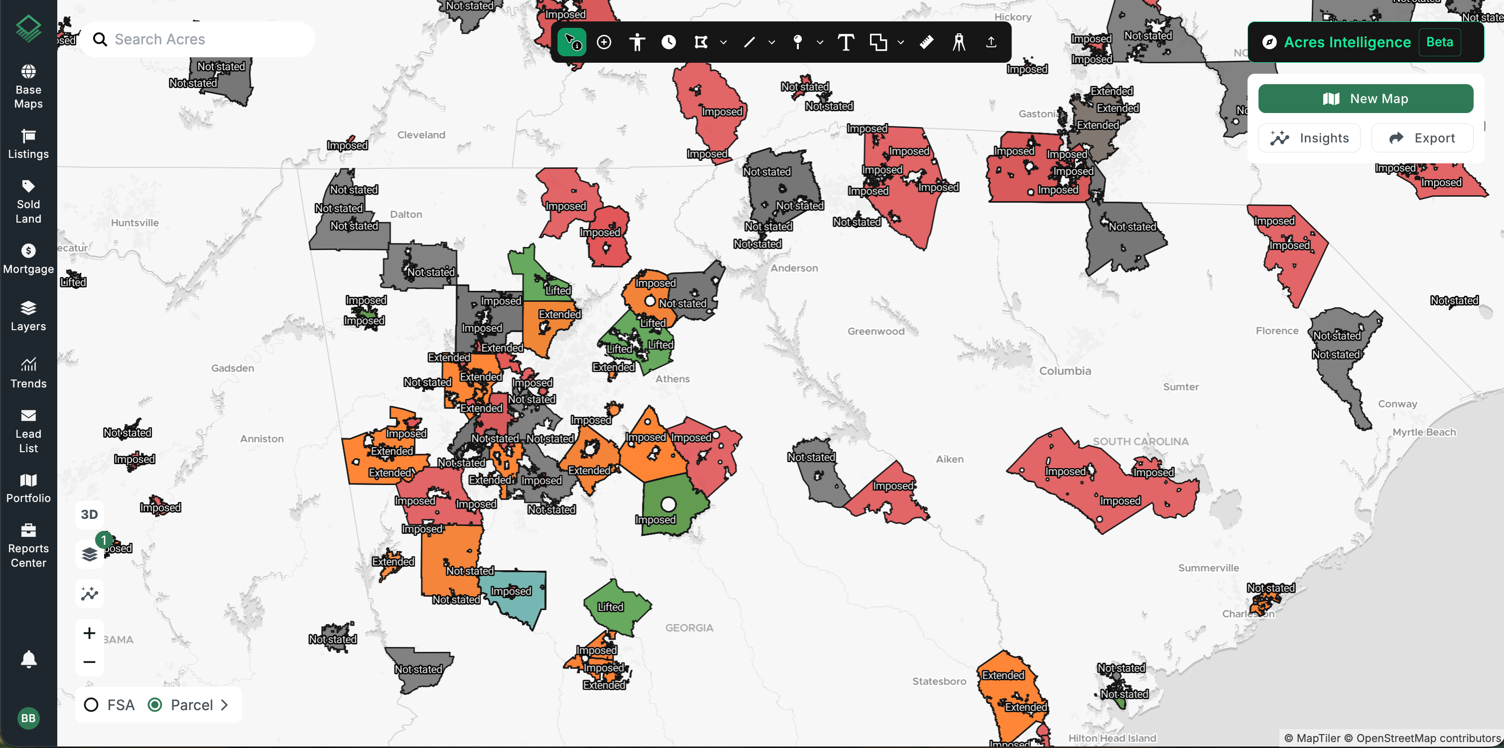
Acres' interactive Civic Moratorium Map, available in our Layer Library, outlines every jurisdiction where a moratorium has been recorded and labels each one with its subject, right on the map.
Each outline is color coded by the action taken:
- Red: Moratorium imposed
- Orange: Moratorium extended
- Green: Moratorium lifted
- Blue: Exemption granted
- Grey: Action not stated in the record
Connect with our sales team today to explore tens of thousands of data layers!
What Data Is Included in Acres’ Civic Moratorium Records?
Click any jurisdiction to open its full record. Key fields include:
- Jurisdiction: The city, county, or township that took action.
- Subject: What the moratorium covers, such as data centers, battery storage, or housing.
- Action and status: Whether it was imposed, extended, lifted, or exempted, and whether it was approved.
- Adopted and expires: The start and end dates, exactly as stated in the record.
- In effect: A quick true or false on whether the moratorium is currently active.
- Area specifications: The specific area is outlines, providing clarity when the pause doesn't cover the whole jurisdiction.
- Case number: The local reference number for the action.
- Source document: A direct link to the agenda or minutes where the moratorium was found, opened to the cited page. Read the details your local officials voted on.
Case Study: Tracking a Battery Energy Storage (BESS) Moratorium in Linn County, KS
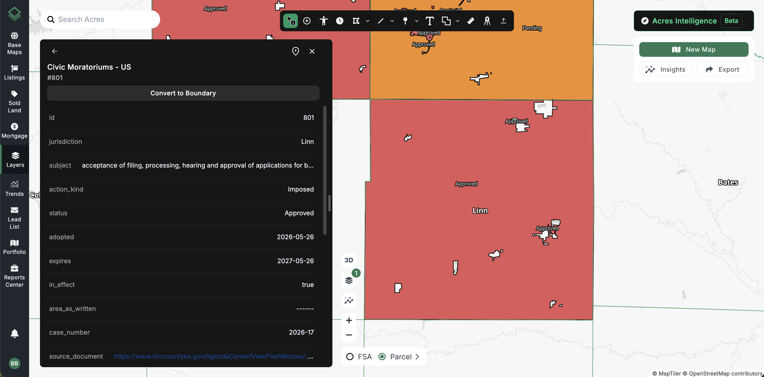
On May 26, 2026, Linn County, Kansas imposed a moratorium on the acceptance, processing, hearing, and approval of applications for battery energy storage. Here's what a single record reveals in Acres:
|
Field |
Value |
|
Jurisdiction |
Linn County, KS |
|
Subject |
Battery energy storage applications |
|
Action |
Imposed |
|
Status |
Approved |
|
Adopted |
05/26/2026 |
|
Expires |
05/26/2027 |
|
In Effect |
Yes |
|
Case Number |
2026-17 |
|
Source |
For a BESS developer, that's a clear signal: no new applications in Linn County until at least May 2027, unless the county lifts or amends the pause, and one click takes you to the minutes to confirm the details.
How Local Moratoriums Impact Site Selection by Industry
Data Centers
- Site Selection Risk: A parcel with power, fiber, and water can still be off the table if the county has paused data center permits. Screening for moratoriums early keeps data center site selection teams from spending months on a site that can't be permitted.
- Timing: Expiration dates help you plan when a market may reopen, and extension history hints at how likely that is.
Energy & Renewables
- Battery Storage and Solar: BESS and utility-scale solar are among the most common moratorium subjects. Knowing which counties have paused them helps energy developers focus outreach where projects can move forward.
- Interconnection Planning: Pair moratorium data with substation and transmission layers to find sites that have both grid access and a clear permitting path.
Residential Builders
- Housing and Subdivisions: Some jurisdictions pause new subdivisions or multifamily permits while they study water, sewer, or school capacity. Builders can spot these constraints before committing to land.
- Fees and Requirements: Moratoriums often precede new impact fees or design standards, so they can signal changing project costs.
Landowners, Brokers & Lenders
- Land Value: A moratorium can temporarily limit who will buy a property and what they'll pay, while a lifted moratorium may reopen demand. Brokers and lenders can factor that into pricing and underwriting.
- Due Diligence: Checking for active moratoriums is a quick, defensible step in any land risk review.
5 Ways to Use the Civic Moratorium Map for Land Due Diligence
- Filter by subject: Filter on subject (data centers, battery storage, housing, and so on) to see only the moratoriums relevant to your project.
- Filter by in effect: Toggle active moratoriums only to see where development is paused today, or include lifted ones to track how a market has changed.
- Check the dates: Adopted and expiration dates are taken directly from the record, so a near-term expiration may point to an upcoming opportunity.
- Go to the source: Open the source document to read the exact language, including any carve-outs or the specific area the moratorium names.
- Layer it for the complete picture: Combine moratorium data with power, sewer, zoning, and more for a full suitability check.
De-Risk Your Next Land Acquisition with Real-Time Moratorium Data
Local moratoriums can change what's possible on a piece of land faster than almost any other factor, and they're often buried in meeting minutes few people read. The Acres U.S. Civic Moratorium layer brings those decisions onto the map, with dates, status, and a link to the original source, so you can move forward with confidence or move on before you've invested time and money.
Explore this and tens of thousands of other data layers with Layers in Acres to make smarter site selection and development decisions.
Book a demo to see the Civic Moratorium layer in action.